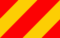
Kłodzko County (Powiat kłodzki)
 |
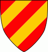 |
The county covers an area of 1643 km2; its territory almost exactly corresponds to the former Bohemian, later Prussian, County of Kladsko (Grafschaft Glatz). It is located in a panhandle called Kłodzko Panhandle. The county's administrative seat is the town of Kłodzko; the other towns are: Duszniki-Zdrój, Nowa Ruda, Polanica-Zdrój, Bystrzyca Kłodzka, Kudowa-Zdrój, Lądek-Zdrój, Międzylesie, Radków, Stronie Śląskie and Szczytna. (The suffix Zdrój appearing in several of these names means "spa".)
As of 2019 the total population of the county was 158,600.
Kłodzko County is bordered by Wałbrzych County to the north-west, Dzierżoniów County to the north and Ząbkowice Śląskie County to the north-east. It also borders the Czech Republic to the east, south and west.
Map - Kłodzko County (Powiat kłodzki)
Map


Country - Poland
 |
 |
| Flag of Poland | |
Poland has a temperate transitional climate and its territory traverses the Central European Plain, extending from Baltic Sea in the north to Sudeten and Carpathian Mountains in the south. The longest Polish river is the Vistula, and Poland's highest point is Mount Rysy, situated in the Tatra mountain range of the Carpathians. The country is bordered by Lithuania and Russia to the northeast, Belarus and Ukraine to the east, Slovakia and the Czech Republic to the south, and Germany to the west. It also shares maritime boundaries with Denmark and Sweden.
Currency / Language
| ISO | Currency | Symbol | Significant figures |
|---|---|---|---|
| PLN | Polish złoty | zÅ‚ | 2 |
| ISO | Language |
|---|---|
| PL | Polish language |


